NOTICE: Public Comments Open during Public Hearing on August 28th, 2019 at 7:30pm Removed from agenda by applicant 8-28-19 - watch for rescheduling
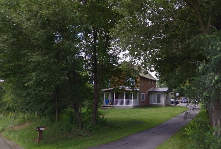
 257 Round Lake Rd
(Meader Lane Residential Subdivision)
25 Single Family homes
This on the Agenda for the August 28, 2019 Town of Ballston Planning Board Meeting at 7:30pm.
This was first before the Planning Board in March of 2019 and last tabled on June 24th, 2019. The applicants are now calling this the Meader Lane Residential Subdivision. This is in the Watershed Overlay Protection District. Josh McGee and Marcus Magee owners and applicants for the Meader Lane Residential Subdivision are proposing a total of 26 lots. Of the 26 lots, 25 are proposed single family lots and lot 26 is proposed as reserved green space.
Tom Suozzo, Project Engineer with Cedarwood Engineering and Jeffrey Anthony, RLA with Studio A presented at the last meeting in June.
Proposed lot
sizes

Total Acreage of Site: 33.97 Acres
Total Non-Build-able: 15.56 Acres

Three
stormwater management ponds are proposed for storage and infiltration. The
Round Lake Road basin is located at the northern end of the property near Round
Lake Road and is in Rhinebeck soils. The South East basin is located below lot
9 south of the proposed connector road near the east property boundary in
Rhinebeck soils. The South Central basin is located at the end of the proposed
cul-de-sac in Deerfield soils.
Meader
Lane Residential Subdivision will be provided with municipal water
service. The water service will be provided by extending the Burnt
Hills-Ballston Water District #2 to this subdivision.
The sewer collection system will be connected to Saratoga County Sewer
District #1 (SCSD#1). The proposed sewer system will consist of 25 individual
exterior grinder pumps connected to a low-pressure force main network. The force
main network will connect to the Benedict Road Residential Subdivision
wastewater collection system.
COMMENTS AND ANSWERS
Cedarwood Engineering stated in a letter to Chair VanVorst (on file in the Building Department office) that this is a compilation of all responses to concerns and comments made to date by the Planning Board. BNU has noticed that during recent Planning Board Meetings the board members reference the comment numbers when addressing issues rather then explaining the topic. This puts the public at a disadvantage and uninformed. For transparent governing this should be posted for the public to view. Below are the comments and their assigned numbers for referrence.COMMENT 1:
The prior comment letters by C.T. Male included comments that some of the lots may not be considered buildable given the presence of wetlands on the property. Some attempts have been made to revise the lot layout, however, Lots 2 and 3 still contain a significant number of wetlands. The applicant shall provide the area of the lot that is considered buildable for consideration by the Board. There is also no proposed grading on the lots, which could further limit the buildable area of these lots.
RESPONSE:
Original Response: We believe there is sufficient buildable area provided for all lots including lots 2 and 3. The grading plan to be provided with the next submission will indicate all buildable areas.
First Revised Response: Large scale drawings for Lots 2 & 3 are enclosed and show grading and proposed house location.
Second Revised Response: Locations of lots 2 & 3 have been adjusted as shown on drawing P‐2.
COMMENT 2:
The applicant shall provide information on who will own Lot 26 and the lot along Round Lake Road that contains a proposed stormwater management area.
RESPONSE:
Original Response: The HOA will own and maintain all proposed storm water management areas including all of Lot 26.
First Revised Response: The drawings have been updated to include labeling for who will maintain ownership of said lots.
Second Revised Response: No updated response.
COMMENT 3:
The applicant should be aware that the Town requires test pits every 500 feet along the proposed road alignment as part of the roadway design.
RESPONSE:
Original Response: The required roadway test pit information will be provided with the next submission.
First Revised Response: Test pits have been preformed and data has been provided on sheet R‐1. Second Revised Response: No updated response.
COMMENT 4:
Sheet P‐1: The lot size/statistics table shall indicate the proposed setback dimensions.
RESPONSE:
Original Response: Sheet P‐1 will be modified to include proposed setback dimensions. First Revised Response: Setback dimensions have been added to sheet P‐1.
Second Revised Response: No updated response.
COMMENT 5:
The location of the proposed stormwater management facilities at the SW and SE corners of the project site are not favorable. The Town does not desire to take over stormwater management areas that are in the rear of homes due to issues with long term maintenance. In addition, the plan does not show any way for the SW stormwater management area to be accessed off the end of the cul‐de‐sac, without impacts to the NYSDEC wetland buffer.
RESPONSE:
Original Response: The HOA will own and maintain the stormwater management areas. The Southeast stormwater management area has a 20 ft access road and an easement will be provided to the town. The Southwest stormwater management area is not needed and will be eliminated from the plans. The Northwest stormwater management area is accessible from the proposed Meader Lane roadway.
First Revised Response: We understand that the town will be maintaining the stormwater retention basin associated with the roadway and must have access. The SW corner basin has been removed from the drawings. The SE corner basin has been moved adjacent to the road to provide for ease of access for the town.
Second Revised Response: No updated response.
COMMENT 6:
On the subdivision plans, for the names of the property owners, it is suggested that “formally” be replaced with “formerly.”
RESPONSE:
Original Response: The correction will be made on the next submission. First Revised Response: Correction has been made.
Second Revised Response: No updated response.
COMMENT 7:
The two lots off MacKenna Court that are immediately adjacent to this project have the owners listed as “Lands now or Formally of John Paul Builders.” The ownership should be revised to include the current property owners. The plans should show the location of the homes on these lots.
RESPONSE:
Original Response: The town clerk will be contacted to obtain all current owners names and those names will be included in the plans. The plans will also be revised to show the location of the homes on these lots.
First Revised Response: Lot ownership labeling has been updated to reflect current ownership. Drawings have been updated to reflect the location of the houses on the subject lots.
Second Revised Response: No updated response.
COMMENT 8:
At the March 27, 2019 Planning Board meeting, the Planning Board Chairman asked the applicant to come up with a method of discouraging traffic from going through MacKenna Court. The plans provided for this submission contain no information on how MacKenna Court will be modified when this project connects to that roadway.
RESPONSE:
Original Response: Applicant will provide and install a ‘Slow‐ Children at Play’ sign.
First Revised Response: Based on comments received during the planning board meeting of 6/24/19 we are proposing the following to discourage through traffic into MacKenna Court. The existing cul‐de‐sac will be converted into a roundabout as shown on drawings, additional signage will be included to discourage through traffic.
Second Revised Response: Per comments received during the in‐person meeting between Jeff Anthony of Studio A, C.T. Male and the town we are proposing the following changes to accompany the cul‐de‐sac already proposed: the width of the road has been reduced, and a curve has been added to the layout of the extension of MacKenna Court.
COMMENT 9:
The Conceptual Green Infrastructure and Stormwater Analysis Report does not contain information on the sizing of the stormwater management areas to provide for peak runoff (10 and 100‐year storm) attenuation. As presented, it is not possible to determine if enough space has been allocated for the stormwater management areas.
RESPONSE:
Original Response: The peak runoff calculations for the 10‐ and 100‐year storm events will be provided with the next submission. Sizing information for these events will also be included with the next submission along with proposed grading and construction details.
First Revised Response: Sizing has been provided for the 10‐ and 100‐year storm attenuation. Second Revised Response: No updated response
COMMENT 10:
In Sections 2.1 and 4.0, it is mentioned that the WQv and CPv are calculated based upon enhanced phosphorous removal requirements for the site. The engineer should be aware that Chapter 10 of the NYS Stormwater Management Design Manual “Enhanced Phosphorous Removal Standards” does not apply to this project since the property is not located within a phosphorous limited watershed. Even so, the Town does not object to the applicant designing their project around these more stringent standards if the applicant desires.
RESPONSE:
Original Response: If enhanced phosphorus removal standards do not apply to this project, we will no longer be applying the more stringent phosphorus standards.
First Revised Response: No updated response.
Second Revised Response: Enhanced phosphorus removal standards have been kept for added treatment.
COMMENT 11:
The Green Infrastructure Plan indicates that 21.15 acres of “conservation of natural areas” are proposed. It is not clear where these areas are located and those areas shall be noted on the plan. As the project progresses, any area designed as a “conservation area” shall be deed restricted.
RESPONSE:
Original Response: Conservation of natural areas will be clearly indicated on the plans. As the project progresses, any area designated as a conservation area will be deed restricted.
First Revised Response: No updated response. Second Revised Response: No updated response.
COMMENT 12:
Section 2.2.2 of the report mentions that “A number of lots naturally drain towards the back of the property, away from the proposed stormwater collection system and towards the project boundaries. These are lots 20 through 25.” Rain gardens are being proposed at the back of these properties. Rain gardens provide runoff treatment, not detention, so it is not clear how the project will attenuate peak runoff rates from these lots if the lots drain away from the stormwater collection system.
RESPONSE:
Original Response: Rain gardens will be replaced with bioretention areas for storm water systems. First Revised Response: Rain gardens have been replaced with bioretention areas as shown on plans. Second Revised Response: No updated response.
COMMENT 13:
Appendix B‐ it is not clear if the depth to water table in the test pit profiles is the water level observed at the time of the test pits, or if it is indicative of mottling, i.e. the seasonally high groundwater table. The date of the test pit and infiltration tests shall also be noted in Appendix B.
RESPONSE:
Original Response: Those were observed water levels. The date of the infiltration of the test pit will be noted in Appendix B in the next submission.
First Revised Response: Clarification has been added to table and date of testing has been added. Second Revised Response: No updated response.
COMMENT 14:
Appendix B‐ For the southeast basin, the test pit log indicates the depth to the water table at 48 inches, but for the infiltration tests, “water in the hole at 24” is noted.
RESPONSE:
Original Response: A discrepancy was noticed in the field. Actual water levels were recorded. Engineer will go out and provide additional percolation tests in this area.
First Revised Response: Storm Basin has been moved from this area and new testing was performed. New soil data has been added.
Second Revised Response: No updated response.
COMMENT 15:
Sanitary Sewer Report: It is suggested that this report be provided to Saratoga County Sewer District #1 for their concurrence. We offer the following comments:
RESPONSE:
Original Response: The report will be provided to Saratoga County Sewer District #1 for its concurrence.
First Revised Response: No revised update.
Second Revised Response: The project has been submitted to the Saratoga County Sewer District for their review.
COMMENT 15a.:
Appendix A of this report shall include the location of the existing sanitary sewer infrastructure, as it is hard to follow in the text of the report.
RESPONSE:
Original Response: A drawing will be added to the report showing the location of the existing sanitary sewer infrastructure.
First Revised Response: Drawing has been added to report to clarify the location of existing sanitary sewer infrastructure.
Second Revised Response: No revised update.
COMMENT 15b.:
In the sewer sizing calculations, the “Benedict Road Subdivision” is referenced, however, it is not clear if the flows being used for the 2” LPSS on MacKenna Court are for the homes on MacKenna Court or for the whole subdivision, some of which does not flow to the 2” LPSS on MacKenna Court.
RESPONSE:
Original Response: The sewer calculations include flows from the entire Benedict Road Subdivision. First Revised Response: No revised update.
Second Revised Response: The new system will no longer be connecting through the 2” LPSS on MacKenna Court, a parallel 3” LPSS will be installed. The sewer report has been updated accordingly.
COMMENT 15c.:
The project is proposing low pressure sanitary sewer, so why are so many manholes shown proposed utility plans?
RESPONSE:
Original Response: Most of the manholes are provided for cleanouts.
First Revised Response: No revised update.
Second Revised Response: All manholes are labeled, they include air relief valves, end of line clean outs and cleanouts.
COMMENT 16:
Water Supply Report: This report shall be updated when the hydrant flow test and modeling is completed. The applicant should be aware that the Town may require the subdivision to be fed from MacKenna Court and Round Lake Road for looping and fire flow purposes.
RESPONSE:
Original Response: Flow test and modeling reports will be provided with the next submittal. First Revised Response: Still working on scheduling for someone to perform tests.
Second Revised Response: Hydrant test has been completed and the water report has been updated accordingly.
ADDITIONAL VERBAL COMMENT
From comments made during the June meeting asking that neighboring wells and septic fields be shown, only one lot was within close proximity that contained these utilities. This lot is located to the east of the Meader Lane entrance along Round Lake Road. Per the NYSDEC Design Standards for Intermediate Sized Wastewater Treatment System the only required separation distance is between the sewer line and the private well and is 50 feet.